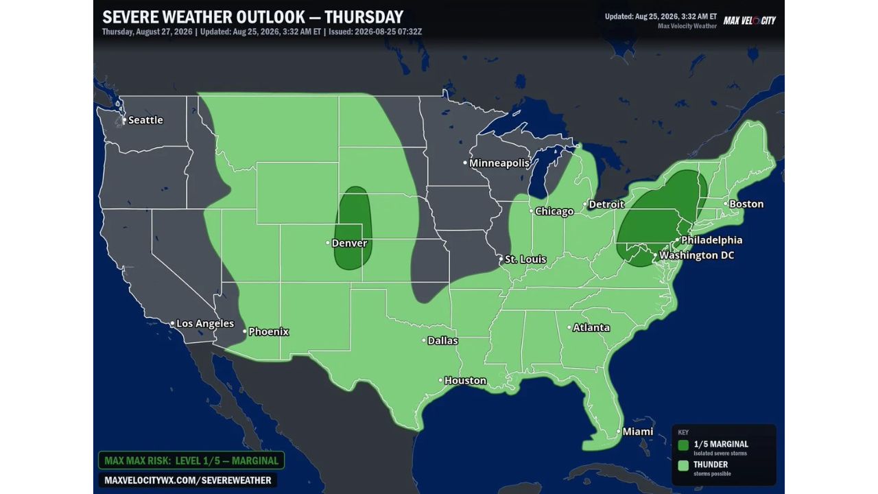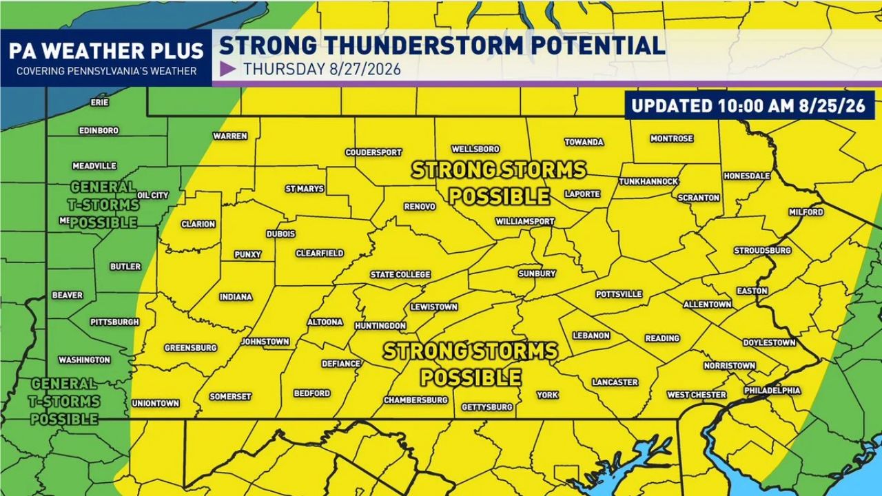
HARRISBURG — A strong storm risk is developing across much of Pennsylvania for Thursday, August 27, as a cold front brings increasing moisture and instability into the state, with damaging winds identified as the greatest threat, along with a risk of flash flooding and an isolated tornado risk. Cities including Scranton, Allentown, Reading, Lancaster, York, and Philadelphia fall within the zone where strong storms are possible Thursday afternoon and evening, according to the latest update issued at 10 a.m. Tuesday.
What Thursday’s Setup Covers
- Timing: Thursday afternoon and evening, August 27
- Primary threat: strong to damaging winds
- Secondary threats: flash flooding, especially in areas with already-saturated soils, and an isolated tornado risk from low-level wind turning
- Coverage area: central and eastern Pennsylvania, including Scranton, Wilkes-Barre, Allentown, Reading, Lancaster, York, Harrisburg, and Philadelphia, with general thunderstorms possible in the western fringe near Pittsburgh and Erie
Why This Setup Matters
Today’s drier, lower-humidity air marks a temporary break before a pattern reversal sets in. Increasing moisture and temperatures ahead of the approaching cold front are expected to combine with growing instability and wind shear by Thursday, an atmospheric setup capable of supporting strong to severe thunderstorms. Forecasters say low-level turning of the winds could add enough spin to the atmosphere to produce an isolated tornado risk, even though the primary concern remains damaging straight-line winds. Abundant moisture ahead of the front also raises the risk of flash flooding, particularly in spots where the ground is already saturated from recent rainfall.
Where Things Stand
This is a forecast outlook for a severe weather threat still two days out, and Thursday’s storms have not yet developed. No watches, warnings, or damage reports currently exist for this event. This article will be updated as the threat window approaches and if the National Weather Service issues watches or warnings ahead of Thursday.
Severe Weather Safety Guide
Before Thursday’s storms arrive:
- Clear gutters and check for drainage issues given the flash flooding risk in saturated areas
- Identify your safe room now: an interior room on the lowest floor, away from windows
- Have a way to receive warnings: a weather radio or phone alerts are critical once watches or warnings are issued
When a warning is issued Thursday:
- Move to shelter immediately if a tornado or severe thunderstorm warning is issued
- Never drive through flooded roadways: turn around, don’t drown
- Stay away from windows during high wind or tornado warnings
After storms pass:
- Avoid downed power lines and treat all as live
- Watch for continued flash flooding on roadways, especially in low-lying areas
- Check on neighbors, particularly those in flood-prone areas
A Midweek Pattern Shift Across the Commonwealth
Thursday’s storm threat marks a sharp turnaround from today’s drier, calmer conditions, as an approaching cold front reshapes the pattern across Pennsylvania. With damaging wind identified as the primary concern and both flooding and an isolated tornado risk layered on top, residents across the central and eastern half of the state are being encouraged to stay weather aware as the week progresses toward Thursday.
For more coverage like this, check back for the latest severe weather updates.