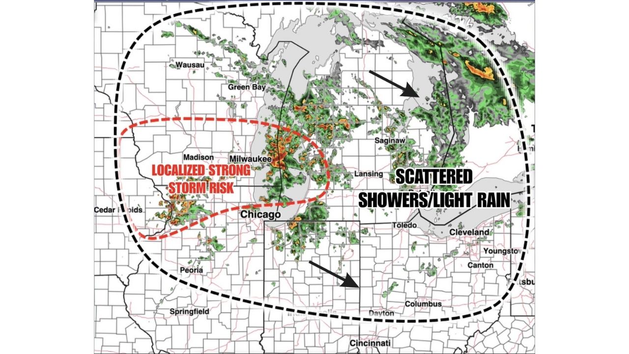
MILWAUKEE — A wet Sunday is unfolding across the northern Ohio Valley, with scattered showers and light rain moving through the region and a localized pocket of stronger storms tracking across northern Illinois, southern Wisconsin and far western Michigan.
Live radar captured at 5 a.m. ET Sunday, August 30 shows widespread shower activity stretching from Wausau and Green Bay through Saginaw, Toledo and Cleveland, with the heaviest and most organized cells clustered near Milwaukee and Madison.
- Localized strong storm risk: Centered over northern Illinois, southern Wisconsin and far western Michigan, including near Milwaukee, Madison and Peoria
- Broader coverage area: Scattered showers and light rain extending east through Lansing, Saginaw, Toledo, Cleveland and Columbus
- Expected totals: Generally light overall, with stronger cells possible through the afternoon in the highlighted risk zone
- Timing: Activity ongoing through Sunday morning, with the stronger storm potential developing into the afternoon
Chicago and Surrounding Areas Watching the Afternoon Trend
While most of the region will see only scattered showers and low rainfall totals, forecasters are flagging the area around Chicago, stretching north into Milwaukee and Madison, as the spot most likely to see a few storms strengthen through the afternoon hours. Areas farther east, including Lansing, Toledo and Cleveland, should see mainly light, scattered rain without the same intensity.
No severe weather or damage has been reported so far Sunday. This article will be updated as radar trends develop through the afternoon.
For more coverage like this, check back for the latest severe weather updates.