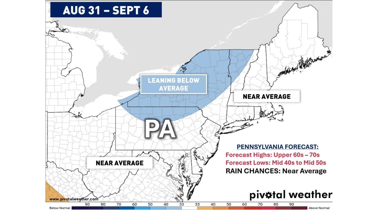
HARRISBURG — Pennsylvania and the broader Northeast are on track for a near average to slightly below average temperature pattern as August closes out and the calendar turns into September, according to the latest Climate Prediction Center outlook covering August 31 through September 6. Forecast highs across Pennsylvania are expected to run in the upper 60s to upper 70s, with overnight lows dropping into the mid 40s to mid 50s for much of the state.
What the Outlook Shows
- Forecast period: August 31 through September 6
- Pennsylvania highs: upper 60s to 70s
- Pennsylvania lows: mid 40s to mid 50s
- Rain chances: near average
- Temperature trend: parts of northern and western Pennsylvania, along with interior New England, are leaning below average, while the rest of the Northeast, including coastal areas, stays near average
Why This Pattern Stands Out
Precipitation chances remain near average for the period, with cold fronts and troughs expected to bring periodic chances for rain and storms rather than an unusually wet or dry stretch. What’s notable isn’t the severity of the pattern, there’s no hazard or alert tied to this outlook, but the timing: this cooler, near-average stretch arrives just over a week before the calendar turns to September, marking an early signal for how the transition out of summer may look across the region.
Where Things Stand
This is a forward-looking pattern outlook for a period that hasn’t yet begun, and no specific storm systems, watches, or warnings have been tied to it. This article will be updated if more specific forecast details or any hazardous weather develops as the window approaches.
Late Summer Planning Guide
As the pattern approaches:
- Expect near normal late-summer weather: no extreme heat or cold is currently indicated for this stretch
- Keep an umbrella handy: near-average rain chances mean periodic showers are possible, not a washout
- Watch for cooler mornings: overnight lows in the mid 40s to mid 50s in parts of the region will feel more like early fall than late summer
A Quiet Signal Ahead of the Seasonal Turn
With Pennsylvania and the Northeast trending toward near to below average temperatures heading into early September, this outlook offers an early look at how the region may transition out of summer, a comparatively calm pattern compared to the more active, hazard-driven setups tracked elsewhere this season.
For more coverage like this, visit Eye of the Hurricane News for the latest severe weather updates.