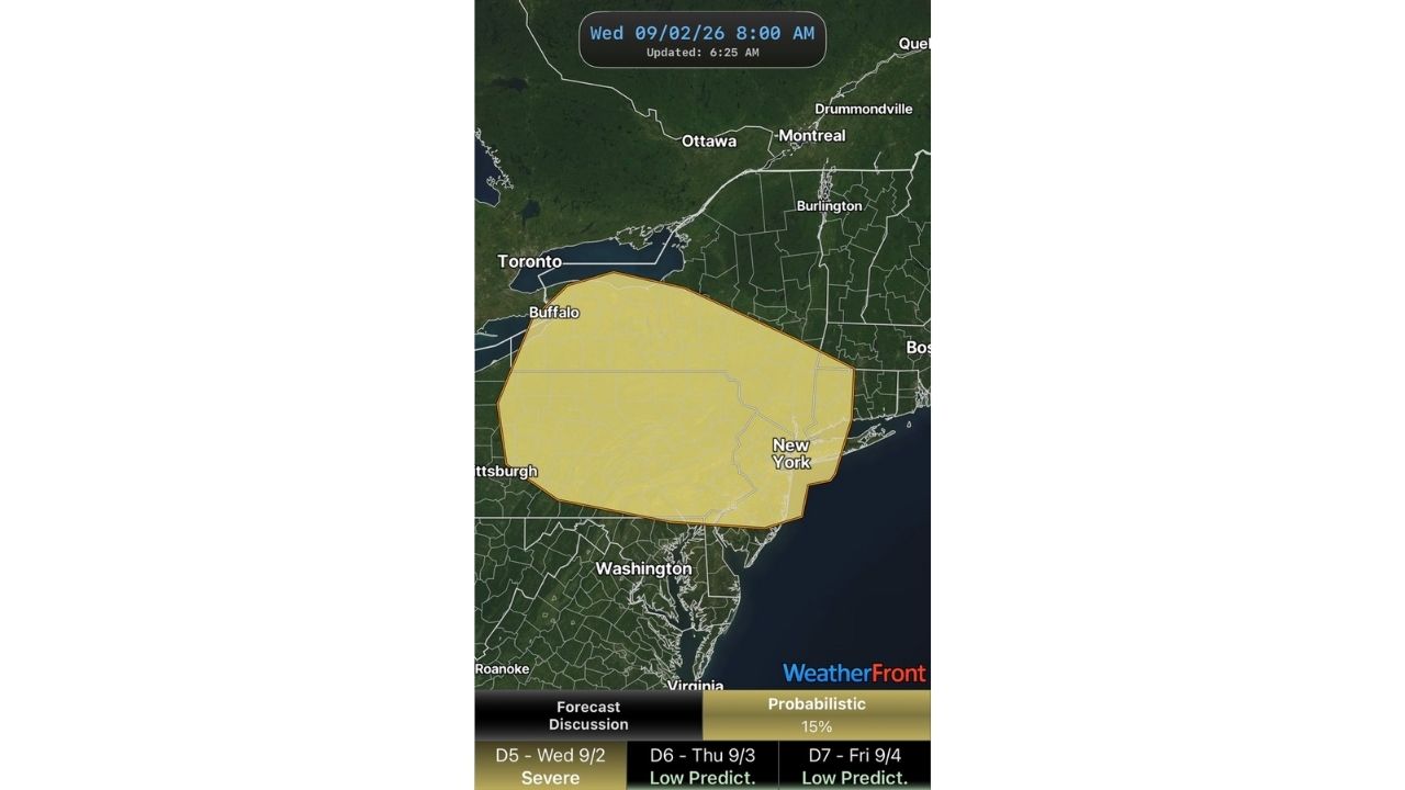
BUFFALO — In an unusually rare move, the Storm Prediction Center has extended a Day 5 severe weather outlook into Wednesday, September 2, placing a 15% probabilistic risk across a zone stretching from Buffalo through Pittsburgh and covering nearly all of New York state.
The outlook, issued at 6:25 a.m. and valid for 8 a.m. Wednesday, marks the start of what forecasters describe as an active stretch, with several atmospheric impulses expected to move through the region beginning as soon as tomorrow and continuing severe weather potential through Friday, September 4.
- Day 5 (Wednesday, Sept. 2): Severe risk highlighted, 15% probabilistic threat from Buffalo to New York
- Day 6 (Thursday, Sept. 3): Low predictability, severe potential remains possible
- Day 7 (Friday, Sept. 4): Low predictability, additional severe chances continue
- Coverage area: From Buffalo and Toronto‘s southern edge through Pittsburgh and across most of New York, including the New York City metro
Extending a severe outlook out to Day 5 is uncommon for the Storm Prediction Center, reflecting higher-than-normal confidence that this multi-day pattern will bring recurring severe weather chances to the Northeast.
An Active Week Ahead as Multiple Storm Systems Line Up
With impulse after impulse forecast to track through the region between Wednesday and Friday, forecasters caution that predictability decreases the further out the outlook extends, even as the overall signal for an active pattern remains strong. Residents from western New York through the Hudson Valley and into the Mid-Atlantic should watch for updates as each system approaches.
No storms have developed yet, and no damage has been confirmed. This article will be updated as the Storm Prediction Center refines outlooks for Thursday and Friday.
For more coverage like this, check back for the latest severe weather updates.