Skip to content

Home

About Us

Advertisement

Contact Us

  • Facebook
  • X
  • Instagram
  • Pinterest
  • WhatsApp
  • RSS Feed
  • TikTok

Dulaney Griffin

Your Trusted Weather Tracker.

Search

Marginal Risk Stretches From Kansas to Michigan as SPC Flags Monday-Tuesday Severe Setup Across the Corn Belt

Melissa Peel Avatar
Melissa Peel
August 30, 2026
Marginal Risk Stretches From Kansas to Michigan as SPC Flags Monday-Tuesday Severe Setup Across the Corn Belt

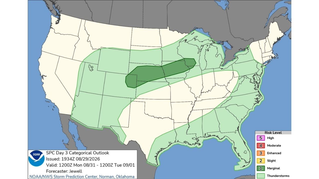
WICHITA — The Storm Prediction Center has placed a Marginal Risk (Level 1) for severe thunderstorms across a wide swath of the central Plains and Corn Belt, valid from noon Monday, August 31 through noon Tuesday, September 1.

The highest-confidence area of severe potential runs as a narrow band from western Kansas and Colorado through Nebraska and into northern Illinois, while the broader thunderstorm risk extends from Denver and Colorado Springs eastward through Kansas City, St. Louis, Chicago, Cleveland and Pittsburgh, reaching as far as the Mid-Atlantic coast.

  • Risk level: Marginal (Level 1 of 5), the lowest severe category on the SPC scale
  • Valid period: 1200Z Monday, August 31 through 1200Z Tuesday, September 1
  • Core threat zone: Central High Plains through parts of the Corn Belt
  • General thunderstorm risk: Extends much farther east, covering most of the Ohio Valley and Mid-Atlantic
  • Issued: 2:35 p.m. CDT Saturday by SPC forecaster Jewell

A Modest Threat With Room to Watch

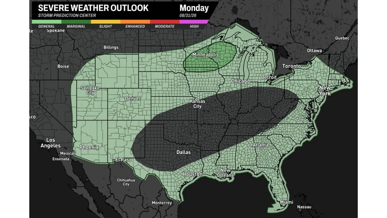
A Marginal Risk designation means isolated severe thunderstorms are possible but widespread severe weather is not expected. Areas within the darker green zone, stretching from the central High Plains into parts of the Corn Belt, carry the greatest concentration of that risk, while the lighter green shading across the rest of the outlook area reflects general thunderstorm coverage without a severe designation attached.

No severe weather has occurred yet, as this outlook covers a period beginning Monday. This article will be updated if the Storm Prediction Center upgrades any portion of this area in later outlooks.

For more coverage like this, check back for the latest severe weather updates.
Featured Articles

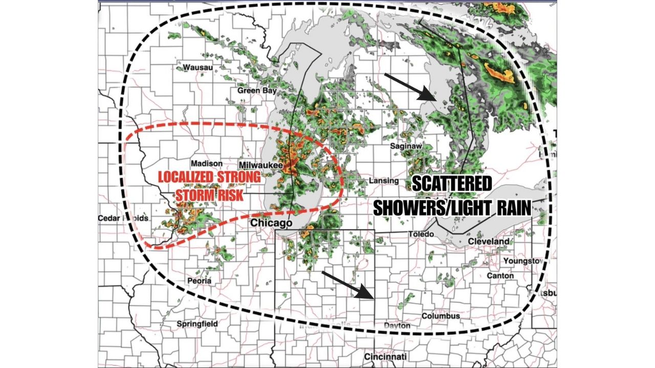
  • Scattered Storms Track Across Milwaukee and Northern Illinois Sunday as Wet Pattern Soaks the Ohio Valley

    Scattered Storms Track Across Milwaukee and Northern Illinois Sunday as Wet Pattern Soaks the Ohio Valley

    August 30, 2026
  • Rare Day 5 Severe Outlook Puts Buffalo and New York Under 15% Storm Threat as Multi-Day Setup Builds Through Friday

    Rare Day 5 Severe Outlook Puts Buffalo and New York Under 15% Storm Threat as Multi-Day Setup Builds Through Friday

    August 30, 2026
  • Marginal Risk Stretches From Kansas to Michigan and Minnesota as SPC Flags Monday-Tuesday Severe Setup Across the Corn Belt

    Marginal Risk Stretches From Kansas to Michigan and Minnesota as SPC Flags Monday-Tuesday Severe Setup Across the Corn Belt

    August 30, 2026
  • Evolving Supercells Threaten 80 MPH Wind Gusts and Golf Ball Hail Across Utah-Nevada Border as Watch Odds Hit 40%

    Evolving Supercells Threaten 80 MPH Wind Gusts and Golf Ball Hail Across Utah-Nevada Border as Watch Odds Hit 40%

    August 30, 2026
  • Marginal Risk Stretches From Kansas to Michigan as SPC Flags Monday-Tuesday Severe Setup Across the Corn Belt

    Marginal Risk Stretches From Kansas to Michigan as SPC Flags Monday-Tuesday Severe Setup Across the Corn Belt

    August 30, 2026

Search

Follow Us on

  • Facebook
  • X
  • Instagram
  • VK
  • Pinterest
  • Last.fm
  • TikTok
  • Telegram
  • WhatsApp
  • RSS Feed

Categories

  • Forecast (68)

About Us

dulaneygriffin

Dulaney Griffin tracks storms, tornado risk, heat and snow across the United States, using National Weather Service and NOAA data. For active warnings in your area, always follow the National Weather Service and your local emergency officials.

Latest Articles

  • Scattered Storms Track Across Milwaukee and Northern Illinois Sunday as Wet Pattern Soaks the Ohio Valley

    Scattered Storms Track Across Milwaukee and Northern Illinois Sunday as Wet Pattern Soaks the Ohio Valley

    August 30, 2026
  • Rare Day 5 Severe Outlook Puts Buffalo and New York Under 15% Storm Threat as Multi-Day Setup Builds Through Friday

    Rare Day 5 Severe Outlook Puts Buffalo and New York Under 15% Storm Threat as Multi-Day Setup Builds Through Friday

    August 30, 2026
  • Marginal Risk Stretches From Kansas to Michigan and Minnesota as SPC Flags Monday-Tuesday Severe Setup Across the Corn Belt

    Marginal Risk Stretches From Kansas to Michigan and Minnesota as SPC Flags Monday-Tuesday Severe Setup Across the Corn Belt

    August 30, 2026

Categories

  • Forecast (68)
  • Instagram
  • Facebook
  • LinkedIn
  • X
  • VK
  • TikTok

Proudly Powered by WordPress | JetNews Magazine by CozyThemes.

Scroll to Top