ORLANDO — Florida is bracing for multiple rounds of storms over the next seven days, with Central and Southern Florida, especially along the West Coast, positioned for the heaviest totals as a wet pattern settles in.
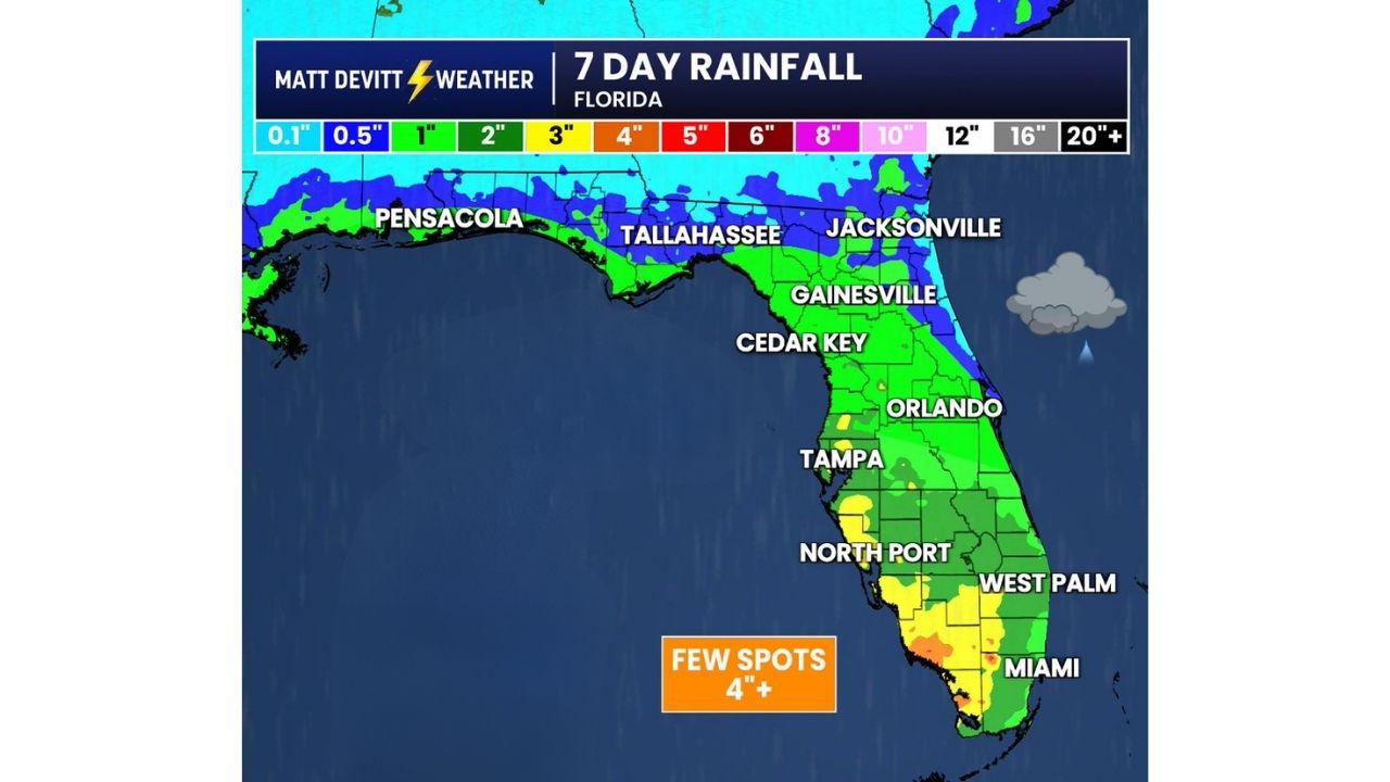
Forecasters say the best potential for 1 to 3 inches of rain stretches from the Tampa and North Port area down through West Palm Beach and Miami, with a few isolated pockets capable of topping 4 inches. Not everyone in those zones will see the higher totals, but the setup keeps daily rain chances elevated statewide.
Why the Numbers Could Climb Later in the Week
Much of this rainfall forecast does not yet factor in extra tropical moisture tied to the remnants of Dolly, which are expected to interact with Florida’s weather pattern during the second half of next week. That means current rainfall projections could trend higher as that moisture arrives.
- Northern Florida: Pensacola, Tallahassee and Jacksonville see lighter totals, generally under an inch to around 2 inches
- Central Florida: Gainesville, Cedar Key and Orlando fall in the 1 to 2 inch range
- West Coast hot spot: Tampa into North Port shows the widest area of 2 to 3 inch potential, with isolated spots near 4 inches
- South Florida: West Palm Beach and Miami also carry pockets of heavier rain, including a few areas flagged for 4 inches or more
Keeping the Umbrella Within Reach All Week
With scattered storms expected daily and the moisture tap widening as Dolly’s remnants move in, Florida residents should plan for on-and-off downpours rather than a single heavy rain event. Localized flooding is possible in the higher-total pockets, particularly along the West Coast.
No flooding or damage has been confirmed yet from this pattern. This article will be updated as rainfall totals and forecasts are refined through the week.
For more coverage like this, check back for the latest severe weather updates.