Skip to content

Home

About Us

Advertisement

Contact Us

  • Facebook
  • X
  • Instagram
  • Pinterest
  • WhatsApp
  • RSS Feed
  • TikTok

Dulaney Griffin

Your Trusted Weather Tracker.

Search

Destructive Winds Exceeding 74 MPH Threaten Corridor From Amarillo to Sioux Falls Today as Hurricane Force Gusts Possible

Melissa Peel Avatar
Melissa Peel
August 25, 2026
Destructive Winds Exceeding 74 MPH Threaten Corridor From Amarillo to Sioux Falls Today as Hurricane Force Gusts Possible

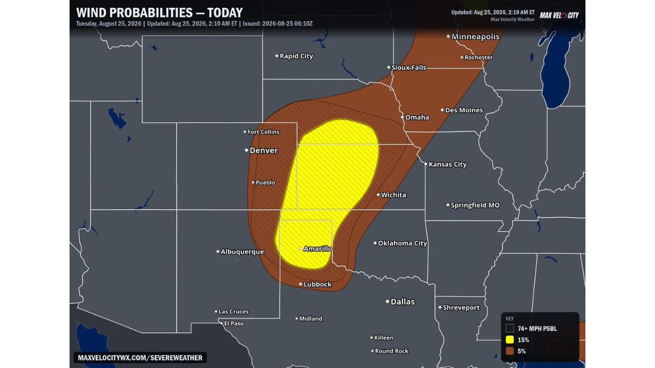
AMARILLO — Forecasters are warning of destructive wind gusts exceeding 74 mph, hurricane force, across a long corridor stretching from the northern Texas Panhandle through western Kansas and Nebraska and into South Dakota and Minnesota today, Tuesday, August 25. The outlook, issued at 2:10 a.m. ET, places the highest probability zone directly over Amarillo and Wichita, with the threat extending north toward Sioux Falls and Minneapolis.

What Today’s Wind Probability Outlook Covers

  • Peak threat: wind gusts exceeding 74 mph, hurricane force
  • 15% probability zone: centered over Amarillo, Lubbock, and Wichita
  • 5% probability zone: extends the corridor north through Denver’s eastern plains, Omaha, Des Moines, Sioux Falls, and into Minneapolis
  • Timing: today, Tuesday, August 25
  • Issued: 2:10 a.m. ET

Why Hurricane-Force Gusts Are Different

Winds exceeding 74 mph cross the official threshold for hurricane-force winds, the same benchmark used to classify a Category 1 hurricane. When a severe thunderstorm complex produces gusts at that intensity, the resulting damage can mirror what’s seen from landfalling tropical systems: snapped power poles, downed trees, and structural damage to roofs and outbuildings, concentrated instead into a narrow, fast-moving corridor rather than a broad hurricane wind field. The 15% probability placed directly over Amarillo and Wichita reflects the zone where forecasters see the greatest likelihood of this level of destructive wind actually verifying today.

Where Things Stand

As of this writing, today’s severe weather has not yet developed, and this outlook reflects forecast risk rather than confirmed storm activity. No wind reports or damage have been confirmed. This article will be updated as storms move through the corridor today and if damage reports become available.

Destructive Wind Safety Guide

Before storms arrive:

  • Secure or bring in loose outdoor items, gusts at this intensity can turn furniture and equipment into projectiles
  • Move vehicles into a garage or away from trees if possible
  • Identify your safe room now: an interior room on the lowest floor, away from windows

When a warning is issued:

  • Move to shelter immediately, hurricane-force gusts can arrive with little additional warning once a warning is issued
  • Stay away from windows and exterior walls

After the storm passes:

  • Avoid downed power lines and treat all as live
  • Watch for structural damage to roofs and outbuildings before going back inside damaged structures
  • Check on neighbors, particularly those in older or manufactured housing

A Long Corridor Under the Same Destructive Threat

Today’s outlook stretches across roughly 700 miles, from the Texas Panhandle to the Upper Midwest, tying together communities as far apart as Amarillo and Minneapolis under the same destructive wind threat. The length and continuity of the corridor underscores an unusually widespread setup for a single day’s severe weather event, rather than a localized or isolated risk.

For more coverage like this, check back for the latest severe weather updates.
Featured Articles

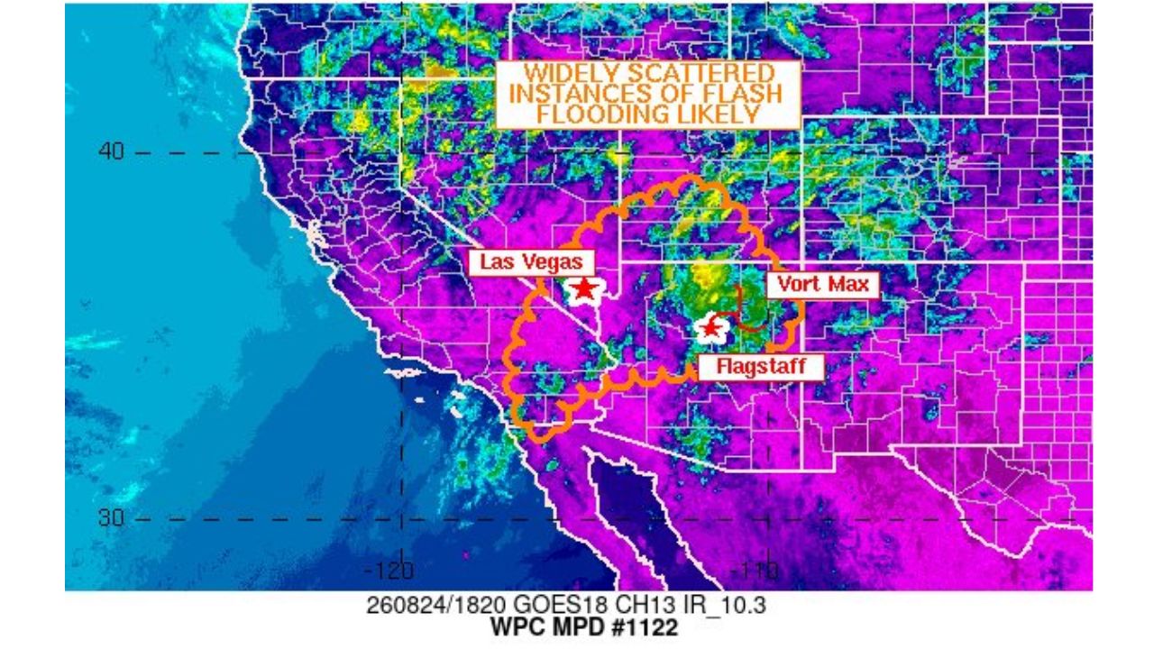
  • Widely Scattered Flash Flooding Likely Across Southwest as Storms Target Las Vegas to Flagstaff Corridor

    Widely Scattered Flash Flooding Likely Across Southwest as Storms Target Las Vegas to Flagstaff Corridor

    August 25, 2026
  • Destructive Winds Exceeding 74 MPH Threaten Corridor From Amarillo to Sioux Falls Today as Hurricane Force Gusts Possible

    Destructive Winds Exceeding 74 MPH Threaten Corridor From Amarillo to Sioux Falls Today as Hurricane Force Gusts Possible

    August 25, 2026
  • 80 MPH Wind Gusts and Isolated Large Hail Prompt Enhanced Risk Upgrade for Texas Panhandle This Evening

    80 MPH Wind Gusts and Isolated Large Hail Prompt Enhanced Risk Upgrade for Texas Panhandle This Evening

    August 25, 2026
  • Two Tropical Systems Show Over 50 Percent Development Chances by September 5 as Forecasters Track Atlantic Disturbances Near Bermuda and Cabo Verde

    Two Tropical Systems Show Over 50 Percent Development Chances by September 5 as Forecasters Track Atlantic Disturbances Near Bermuda and Cabo Verde

    August 25, 2026
  • 75 MPH Wind Gusts and 2 Inch Hail Threaten Central Plains Thursday as Isolated Storms Also Target Pennsylvania to New York

    75 MPH Wind Gusts and 2 Inch Hail Threaten Central Plains Thursday as Isolated Storms Also Target Pennsylvania to New York

    August 25, 2026

Search

Follow Us on

  • Facebook
  • X
  • Instagram
  • VK
  • Pinterest
  • Last.fm
  • TikTok
  • Telegram
  • WhatsApp
  • RSS Feed

Categories

  • Forecast (42)

About Us

dulaneygriffin

Dulaney Griffin tracks storms, tornado risk, heat and snow across the United States, using National Weather Service and NOAA data. For active warnings in your area, always follow the National Weather Service and your local emergency officials.

Latest Articles

  • Widely Scattered Flash Flooding Likely Across Southwest as Storms Target Las Vegas to Flagstaff Corridor

    Widely Scattered Flash Flooding Likely Across Southwest as Storms Target Las Vegas to Flagstaff Corridor

    August 25, 2026
  • Destructive Winds Exceeding 74 MPH Threaten Corridor From Amarillo to Sioux Falls Today as Hurricane Force Gusts Possible

    Destructive Winds Exceeding 74 MPH Threaten Corridor From Amarillo to Sioux Falls Today as Hurricane Force Gusts Possible

    August 25, 2026
  • 80 MPH Wind Gusts and Isolated Large Hail Prompt Enhanced Risk Upgrade for Texas Panhandle This Evening

    80 MPH Wind Gusts and Isolated Large Hail Prompt Enhanced Risk Upgrade for Texas Panhandle This Evening

    August 25, 2026

Categories

  • Forecast (42)
  • Instagram
  • Facebook
  • LinkedIn
  • X
  • VK
  • TikTok

Proudly Powered by WordPress | JetNews Magazine by CozyThemes.

Scroll to Top