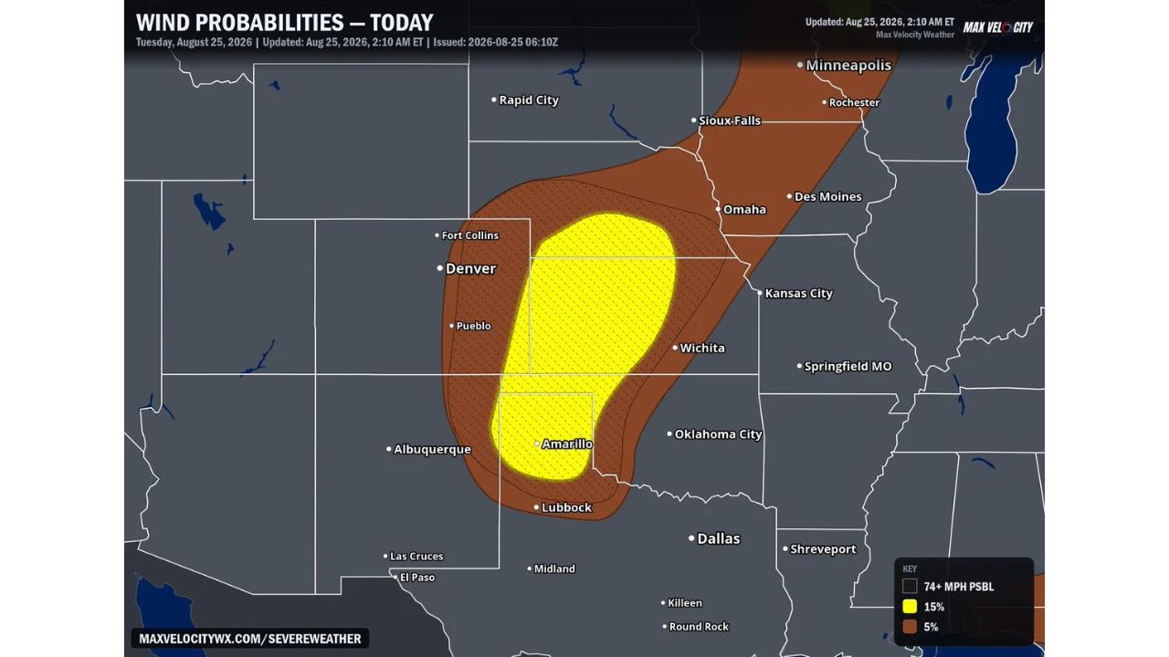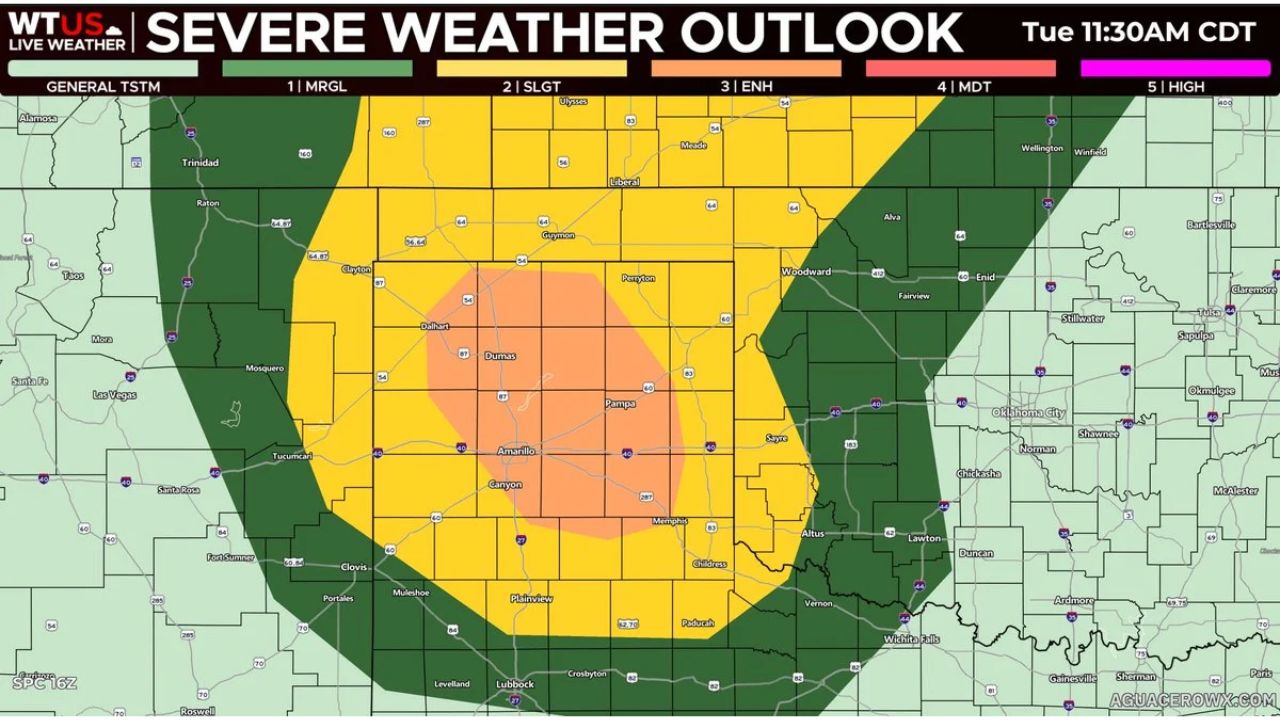
AMARILLO — Forecasters upgraded today’s severe weather risk to a Level 3 Enhanced Risk across parts of the Texas Panhandle, including Amarillo, Dumas, Pampa, and Canyon, as a complex of storms is expected to move through the region this evening. Damaging winds, with some gusts reaching up to 80 mph, are the primary driver behind the upgrade, with isolated large hail also possible.
What the Enhanced Risk Covers
- Risk level: Level 3 of 5, Enhanced Risk, centered directly over Amarillo, Dumas, Pampa, and Canyon
- Surrounding risk: Level 2 Slight Risk extends outward to Dalhart, Perryton, Clarendon, and Childress
- Broader area: Level 1 Marginal Risk stretches into eastern New Mexico and western Oklahoma, including Clovis, Tucumcari, and Woodward
- Primary threat: damaging wind gusts, some reaching 80 mph
- Secondary threat: isolated large hail
- Timing: this evening, as a storm complex moves through the area
- Issued: Tuesday, 11:30 a.m. CDT
Why the Enhanced Risk Upgrade Matters
Moving a risk area up to Level 3 Enhanced signals that forecasters now have higher confidence in a more significant, organized severe weather event than a standard Slight Risk would suggest. Wind gusts reaching 80 mph fall well into the range capable of downing trees, damaging roofs, and knocking out power, comparable to the strength of a strong tropical storm. The concentrated placement of the enhanced zone directly over Amarillo and the surrounding Panhandle communities means this evening’s storm complex is expected to bring its most intense impacts to the same area home to the region’s largest population base.
Where Things Stand
As of this writing, the storm complex has not yet moved through the region, and this outlook reflects a forecast risk for later today. No damage or wind reports have been confirmed. This article will be updated as the storms develop this evening and if damage reports come in.
Severe Weather Safety Guide
Before storms arrive this evening:
- Secure loose outdoor items ahead of gusts that could reach 80 mph
- Move vehicles under cover given the isolated large hail threat
- Identify your safe room now: an interior room on the lowest floor, away from windows
When a warning is issued:
- Move to shelter immediately if a severe thunderstorm warning is issued for your area
- Stay away from windows during high wind or hail
After the storm passes:
- Avoid downed power lines and treat all as live
- Check for hail and wind damage to your property before heading outside
An Evening Threat Centered Squarely on the Panhandle
Tuesday’s Enhanced Risk upgrade puts Amarillo and the surrounding Texas Panhandle at the center of tonight’s most significant severe weather threat in the region, with the concentrated Level 3 zone reflecting forecasters’ growing confidence that this evening’s storm complex will bring damaging, widespread wind impacts rather than isolated, scattered activity.
For more coverage like this, check back for the latest severe weather updates.