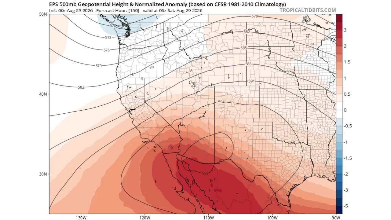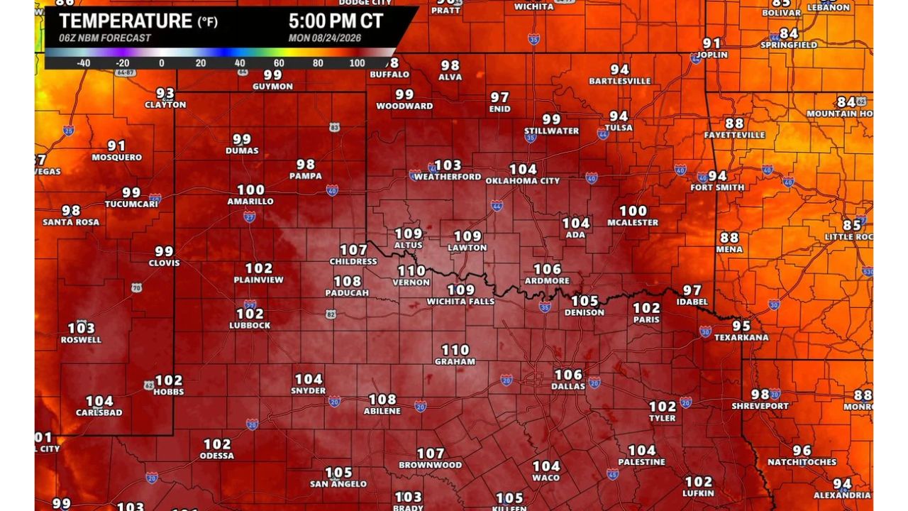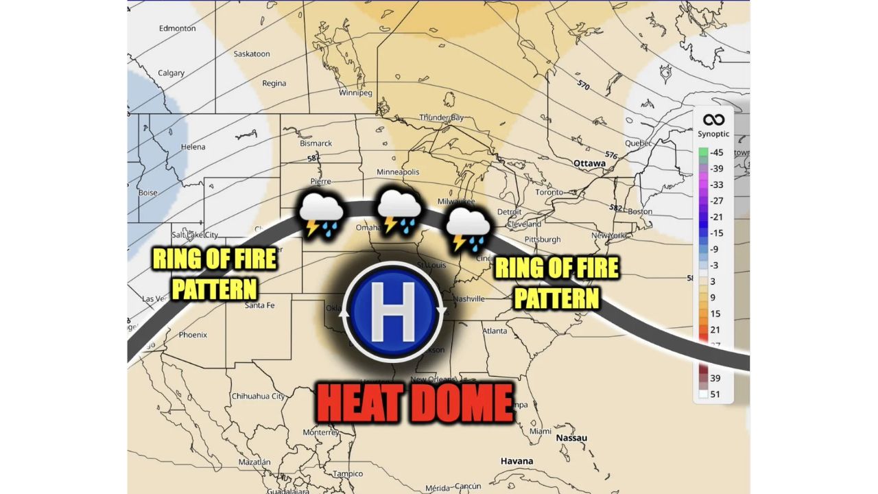
MINNEAPOLIS — A Heat Dome is set to rebuild across the southern United States heading into next week, pushing storm chances back into the Midwest as the ridge sets up a classic “Ring of Fire” pattern for the period spanning roughly August 30 through September 5. The setup would send repeated rounds of thunderstorms arcing around the northern edge of the dome, tracking near cities including Bismarck, Minneapolis, Milwaukee, Detroit, Pittsburgh, and Cleveland.
What the Pattern Shows
In a Ring of Fire setup, a strong area of high pressure, the Heat Dome, parks itself over the southern US, and storm systems get funneled around its northern and eastern edges rather than moving through the dome itself. That storm track is shown arcing from the northern Plains through the upper Midwest and into the Great Lakes and Northeast, passing near Bismarck, Minneapolis, Milwaukee, Detroit, Pittsburgh, and Cleveland during the ~August 30 to September 5 window.
Why This Pattern Matters
Forecasters note this setup does not currently look as extreme as the Heat Dome pattern seen in mid-August, but it’s one worth watching as the timeframe gets closer. For areas under the dome itself, that generally means continued hot, dry conditions, while communities along the storm track arcing around it face repeated chances for rain and thunderstorms as one system after another rides the ridge’s northern flank.
Where Things Stand
This is an early pattern outlook for a window that hasn’t started yet, no watches, warnings, or specific hazard data have been issued for this period. This article will be updated as the pattern comes into better focus and if the National Weather Service issues more specific outlooks closer to August 30.
Preparedness Guide for a Returning Storm Pattern
As the pattern develops:
- Watch for updated outlooks as the window approaches, specific hazard details will sharpen closer to August 30
- Keep an eye on daily forecasts if you’re in the storm track from the northern Plains through the Great Lakes
If you’re under the Heat Dome:
- Stay hydrated and limit outdoor exertion during peak afternoon heat
- Check on vulnerable neighbors during extended hot stretches
When storms move through:
- Have a way to receive warnings, conditions can change quickly once systems begin riding the ridge
A Pattern Reminiscent of Mid-August, But Not as Extreme
This setup mirrors the Ring of Fire pattern the region saw in mid-August, though forecasters say the current signal looks less intense. Still, with the Heat Dome expected to rebuild over the South and a storm track taking shape across the Midwest and Great Lakes, it’s a pattern worth monitoring as late August turns into early September.
For more coverage like this, visit Eye of the Hurricane News for the latest severe weather updates.