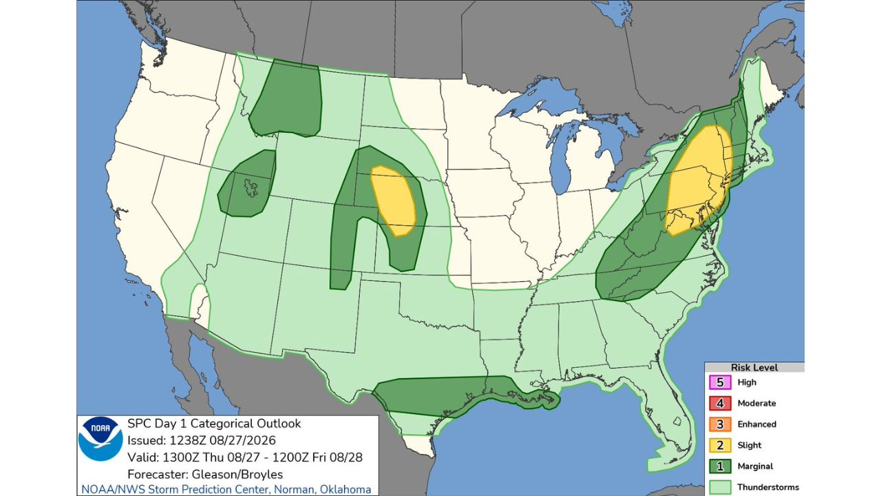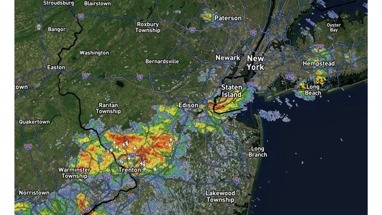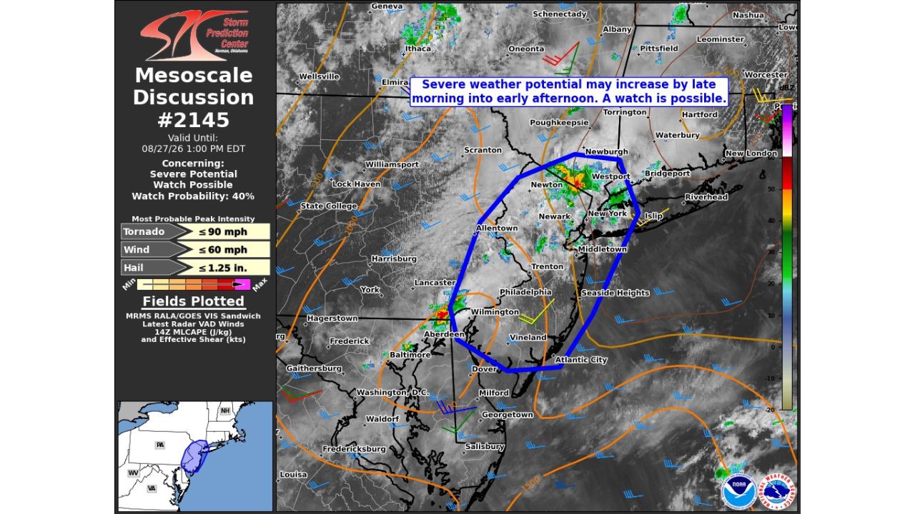
NEW YORK — The Storm Prediction Center issued Mesoscale Discussion #2145 at 9:58 a.m. CDT, warning that severe weather potential may increase across the New York City metro, northern New Jersey, and the Jersey Shore by late morning into early afternoon. Forecasters put the probability of a formal watch being issued at 40%, with the discussion valid until 1 p.m. EDT.
Storm Prediction Center Flags a Watch-Worthy Setup From Newburgh to Atlantic City
The discussion outlines a zone stretching from Newburgh and Westport in the north down through New York City, Newark, Trenton, and Philadelphia, extending to the coast near Atlantic City and Seaside Heights. Forecasters say severe weather potential may increase by late morning into early afternoon, with a 40% probability that the Storm Prediction Center will upgrade the situation to a formal severe thunderstorm or tornado watch before the discussion expires.
Breaking Down the Numbers Behind Today’s Watch Possibility
The discussion lists most probable peak intensities for each hazard type: wind gusts up to 60 mph, hail up to 1.25 inches, and tornado-associated winds up to 90 mph. A Mesoscale Discussion like this one serves as a bridge between routine forecasting and a formal watch, giving forecasters a chance to flag developing conditions in real time using the latest radar, satellite, and atmospheric data, in this case pulling from MRMS radar, GOES satellite imagery, VAD wind profiles, and instability and shear data.
No Watch Issued Yet as the Midday Window Approaches
As of this writing, no formal watch has been issued, and this discussion reflects an evolving, still-developing situation rather than confirmed severe weather. No damage or storm reports have been confirmed. This article will be updated if the Storm Prediction Center issues a formal watch or if storms produce confirmed impacts across the region.
Getting Ready as the Metro Area’s Afternoon Threat Builds
Through late morning and early afternoon:
- Stay weather aware, especially if you’re in the corridor stretching from the NYC metro to Atlantic City
- Have a way to receive warnings, a weather radio or phone alerts will be critical if a watch is issued
- Secure loose outdoor items ahead of potential gusts up to 60 mph
If a watch or warning is issued:
- Move to an interior room away from windows if a warning is issued for your location
- Avoid travel through the highlighted zone if storms develop as forecast
After storms pass:
- Avoid downed power lines and treat all as live
- Check for damage in areas that saw the strongest winds or hail
A Densely Populated Corridor Watches the Sky Closely
With the discussion’s outlined zone covering some of the most densely populated parts of the country, from the NYC metro through northern New Jersey to the Jersey Shore, even a 40% chance of a formal watch is enough to keep millions of residents monitoring conditions closely as late morning turns to early afternoon.
For more coverage like this, check back for the latest severe weather updates.