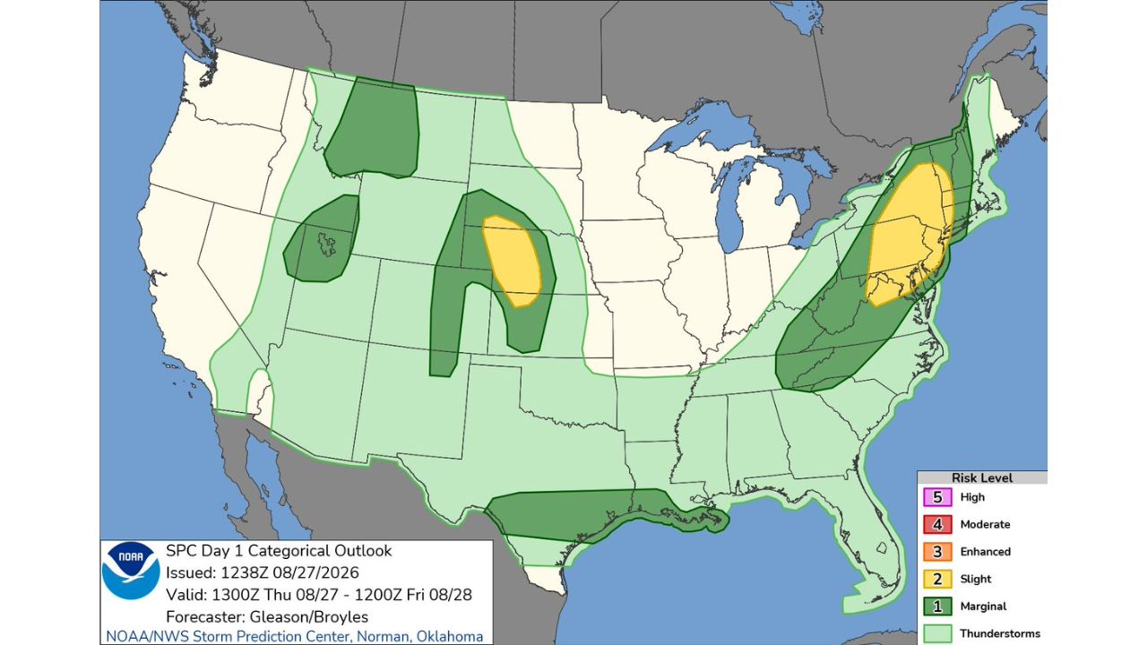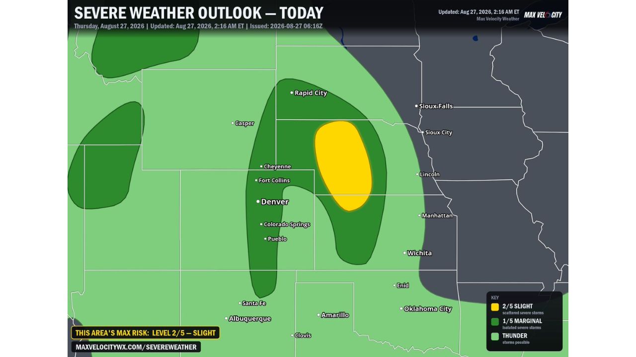
RAPID CITY — Nebraska is in the bullseye for severe weather today, Thursday, August 27, as upslope flow triggers isolated storms off the Front Range early this afternoon that will track eastward into a pocket of stronger instability. Forecasters warn the strongest cells could organize into robust supercells capable of producing very large hail up to 2 inches in diameter and damaging wind gusts topping 70 mph.
What Today’s Outlook Covers
- Highest risk level: Slight Risk (2 of 5), centered over central and western Nebraska near Rapid City
- Surrounding risk: Marginal Risk (1 of 5) extends across Wyoming, Colorado, and into western South Dakota
- Primary hazards: hail up to 2 inches in diameter and wind gusts topping 70 mph
- Storm mode: isolated storms developing off the Front Range, organizing into a few robust supercells as they track east
- Additional threat: a rogue severe storm also possible along the I-25 corridor in Colorado, near Denver, Fort Collins, and Colorado Springs
Why This Setup Matters
Today’s storms are expected to initiate from upslope flow along the Front Range, a common trigger for early-afternoon development in this part of the country. What makes this setup notable is what happens once that activity tracks into central and western Nebraska: forecasters say it will tap into a pocket of stronger instability and favorable wind shear, ingredients that allow storms to organize into supercells rather than staying as disorganized, short-lived cells. Hail approaching 2 inches, roughly hen-egg size, is capable of causing significant damage to vehicles, roofing, and crops, while gusts over 70 mph can down trees and power lines.
Where Things Stand
As of this writing, today’s storms have not yet developed, and this outlook reflects a forecast risk for the afternoon and evening. No damage or storm reports have been confirmed. This article will be updated as storms develop and if reports come in later today.
Severe Weather Safety Guide
Before storms develop this afternoon:
- Move vehicles under cover, given the potential for hail up to 2 inches
- Secure loose outdoor items ahead of gusts that could top 70 mph
- Have a way to receive warnings, a weather radio or phone alerts, especially in central and western Nebraska**
When a warning is issued:
- Move to shelter immediately if a severe thunderstorm warning is issued
- Stay away from windows during hail or high wind
After storms pass:
- Check for hail and wind damage to vehicles, roofing, and property
- Avoid downed power lines and treat all as live
Colorado’s I-25 Corridor Also in Play
While Nebraska carries the day’s highest risk, forecasters aren’t ruling out a rogue severe storm along Colorado’s I-25 corridor, stretching through Fort Collins, Denver, Colorado Springs, and Pueblo. That threat remains lower-end and less certain than the Nebraska risk, but it adds a second area worth watching as the same upslope-driven pattern plays out across the region today.
For more coverage like this, check back for the latest severe weather updates.