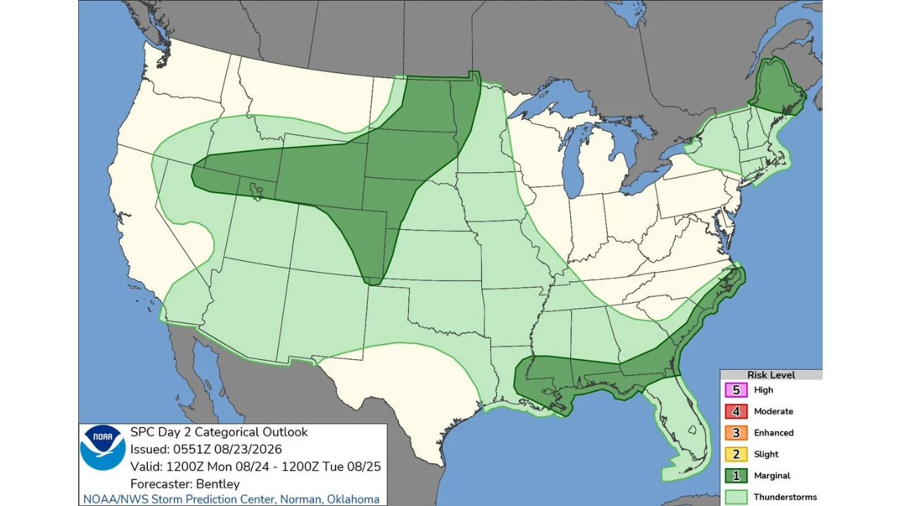
RAPID CITY — Monday’s Marginal Risk footprint grew significantly in the Storm Prediction Center’s latest Day 2 outlook, now spanning three separate regions: the northern Great Basin into the central High Plains and northern Plains, a Gulf Coast corridor stretching from Louisiana into the Florida Panhandle, and a pocket over northern Maine. The outlook, issued at 0551Z, is valid 1200Z Monday, Aug. 24 through 1200Z Tuesday, Aug. 25.
- Risk level: Marginal (1 of 5)
- Zone 1: northern Great Basin into central High Plains and northern Plains, roughly Idaho/Montana through the Dakotas
- Zone 2: Gulf Coast, Louisiana through the Florida Panhandle
- Zone 3: northern Maine
- Valid: 1200Z Mon., Aug. 24 through 1200Z Tue., Aug. 25
- Forecaster: Bentley, SPC Norman, Oklahoma
How This Outlook Changed From the Earlier Day 3 Look
Just a day earlier, the Storm Prediction Center’s Day 3 outlook for this same Monday flagged a single Marginal Risk zone confined to the central and northern Plains. This updated Day 2 version keeps that Plains zone largely intact but adds two entirely new areas, a Gulf Coast band and a separate pocket over northern Maine, that weren’t part of the earlier outlook at all. That kind of expansion between Day 3 and Day 2 outlooks is typical as forecasters gain more confidence and finer detail closer to the event, but the addition of two geographically distant new zones shows just how much a forecast picture can shift in just 24 hours.
What to Watch For as Monday Approaches
As of this writing, this remains a Day 2 outlook and does not represent a confirmed watch or warning in any of the three zones. No severe thunderstorm watches have been issued, and none would be expected this far in advance. This article will be updated as the outlook is refined further in the Day 1 update closer to Monday.
For more coverage like this, check back for the latest severe weather updates.