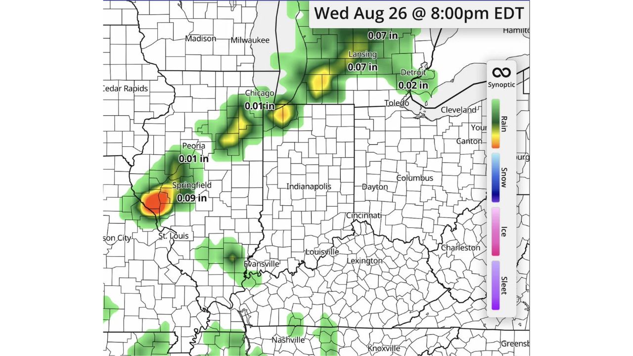
SPRINGFIELD — After a stretch of quieter weather, forecasters are already looking ahead to Wednesday, Aug. 26, for a potential return of storms across the Midwest, though exact timing, placement and risks all remain uncertain this far out. Simulated radar for 8 p.m. EDT Wednesday shows scattered rain activity stretching from Springfield and Peoria, Illinois through Chicago and up into Lansing and Detroit, Michigan.
Early model output points to relatively light totals if this pattern verifies as shown, with Springfield picking up around 0.09 inches, Lansing near 0.07 inches, and Chicago closer to 0.01 inches, though these numbers reflect just one simulated snapshot nearly a week in advance.
Why This Early Look Comes With Heavy Caveats
Forecasters were explicit that this is a preliminary look, not a forecast residents should treat as settled. At six days out, model simulations like this one are prone to shifting significantly as the event gets closer, meaning the specific placement, timing and even whether storms develop at all could look very different by the time Wednesday actually arrives. The value of flagging it this early isn’t precision, it’s giving residents a heads-up that a pattern change may be on the way after the current quieter stretch.
What to Watch For as Wednesday Approaches
As of this writing, this is an early model look at Wednesday evening, not a forecast outlook or any kind of watch or warning. No specific hazards, whether severe weather, flooding, or otherwise, have been identified at this stage. This article will be updated as forecasters refine the outlook in the coming days.
For more coverage like this, check back for the latest severe weather updates.