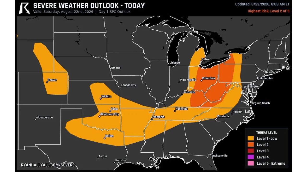
COLUMBUS — A Level 2 severe weather risk targets damaging wind across Ohio, West Virginia and into the Appalachians Saturday, putting roughly 16.8 million people in the zone as a weak front pushes storm clusters through the region this afternoon. Wind gusts are the main story, though forecasters noted some hail is possible too.
Timing splits by city. Akron and Cleveland look busiest right around 2 p.m., while Columbus, sitting further south along the same corridor, sees its activity ramp up about an hour later, near 3 p.m. The Level 2 zone forms a tight band running roughly from Detroit south through Columbus and down toward Louisville, with a much larger surrounding Level 1 area stretching from Denver and Oklahoma City through Nashville, Charlotte and up to Washington, D.C.
Why the One-Hour Gap Between Cities Matters
A weak front pushing storm clusters through in sequence, rather than a single line arriving everywhere at once, means the Akron-to-Cleveland corridor and the Columbus area face genuinely different windows for their worst conditions. That roughly one-hour gap gives forecasters a useful marker: residents further north should be watching closely as 2 p.m. approaches, while those around Columbus have a bit more runway before the same storm clusters reach them closer to 3 p.m.
What to Watch For This Afternoon
As of this writing, this is a Day 1 outlook with the day’s severe weather still ahead across the highlighted corridor. No severe thunderstorm watches tied to the Ohio, West Virginia and Appalachians zone have been issued yet. This article will be updated as watches, warnings, or storm reports develop through the afternoon, particularly as the 2 p.m. and 3 p.m. windows for Akron/Cleveland and Columbus approach.
For more coverage like this, check back for the latest severe weather updates.