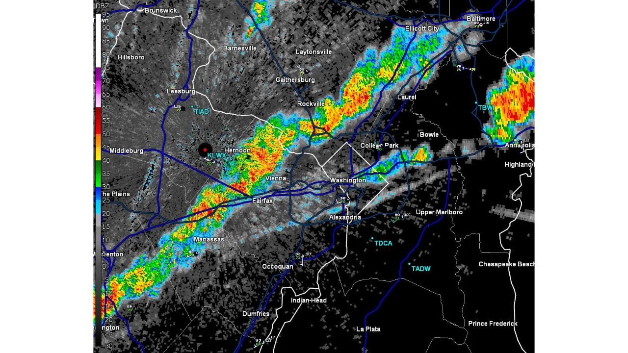
WASHINGTON, D.C. — A line of storms reached the Beltway and I-95 north of D.C. by 5 p.m. Friday, approaching the city from the west as it stretched from Manassas and Fairfax through Rockville, Laurel and toward Baltimore. The storms remain sub-severe for now, but forecasters warned a few warnings could still develop as the line crosses the region over the next one to two hours, with gusty wind and lightning the main threats.
The line ran in a long, continuous band on radar, from near Manassas in the south through Herndon, Vienna, Rockville and Ellicott City, with a separate cell near Baltimore-Washington International Airport also showing strong reflectivity. Washington, Alexandria and College Park all sat directly in the storm’s path as it pushed east.
Why “Sub-Severe” Doesn’t Mean Low Risk
Storms tracking as sub-severe haven’t yet met the official wind or hail thresholds for a severe thunderstorm warning, but that status can change quickly as a line like this one continues to intensify while crossing a metro area. With the primary threats identified as gusty wind and lightning, and forecasters explicitly flagging that a few warnings remain possible over the next couple of hours, residents across the D.C. metro shouldn’t read “sub-severe” as “no threat,” particularly with the line still actively approaching the city from the west at the time of this update.
What to Watch For Over the Next Two Hours
As of this writing, the storm line was actively crossing the Beltway and pushing toward Washington and points east, with the sub-severe designation still in place. No severe thunderstorm warnings had been confirmed as of 5 p.m. This article will be updated if warnings are issued or confirmed wind damage is reported as the line moves through Washington, Alexandria, College Park and Baltimore over the next one to two hours.
For more coverage like this, check back for the latest severe weather updates.