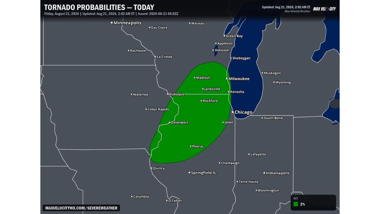
MADISON, Wis. — Scattered thunderstorms developing Friday afternoon could produce a quick tornado somewhere along a corridor stretching from Davenport, Iowa through Rockford and Madison to Milwaukee, Wisconsin, with a 2 percent tornado probability covering the zone.
The highlighted area runs in a narrow band from near Quincy and Davenport in the south, north through Dubuque, Rockford and Janesville, up to Madison and Milwaukee, brushing the western edge of Chicago and Joliet without fully including them.
Why “Quick” Is the Key Word Here
A 2 percent tornado probability sits at the low end of the scale, but the description of a quick tornado matters as much as the number itself. Scattered afternoon storms, rather than an organized line or supercell cluster, tend to produce brief, fast-spinning tornadoes with limited advance warning if they do develop, since the parent storms themselves aren’t always well-organized enough to give forecasters a clear rotation signature until the threat is already close. That’s different from a more classic tornado setup tied to a strong, well-defined supercell, where warnings often come with more lead time.
What to Watch For This Afternoon
As of this writing, this is a forecast outlook for Friday afternoon, not a confirmed watch or warning. No severe thunderstorm or tornado watches tied to this corridor have been issued yet. Because scattered storms can develop and organize quickly, this article will be updated as watches, warnings, or storm reports emerge across the Davenport-to-Milwaukee corridor.
For more coverage like this, check back for the latest severe weather updates.