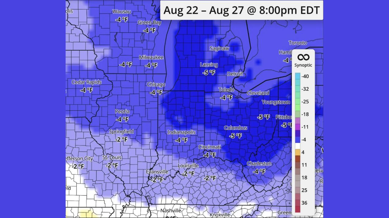
CHICAGO — A calmer, cooler stretch is settling in behind today’s storms, with temperatures running 2 to 5 degrees below average across a wide swath of the Ohio Valley and Midwest from August 22 through August 27. The coolest departures, 5 degrees below normal, are concentrated around Columbus, Lansing, Pittsburgh and Youngstown, while cities including Chicago, Milwaukee, Indianapolis and Cincinnati sit closer to 4 degrees below average.
Where the Cool-Down Runs Deepest
- -5°F: Columbus, Lansing, Pittsburgh, Youngstown, Charleston
- -4°F: Chicago, Milwaukee, Green Bay, Wausau, Cedar Rapids, Peoria, Indianapolis, Toledo, Cleveland, Cincinnati, Hamilton
- -2°F: Springfield, St. Louis, Jefferson City, Louisville, Evansville
Why This Break Matters After an Active Stretch
A widespread multi-day departure below normal, rather than a single cooler afternoon, gives the Ohio Valley and surrounding Midwest genuine relief after a run of active, storm-heavy days across the region. Because the cooling spans nearly a full week, from August 22 through 27, it’s substantial enough to actually lower cooling demands and offer a real break outdoors, rather than a brief dip that reverses within a day or two.
What to Expect Through the Week
As of this writing, this outlook covers the period through August 27, with the coolest air settling in behind today’s storm activity. This article will be updated if the temperature outlook shifts or if the cooler pattern breaks down earlier than expected.
For more coverage like this, check back for the latest severe weather updates.