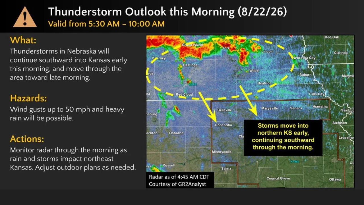
CONCORDIA — Storms tracking south out of Nebraska early Saturday will push into northern Kansas and continue through late morning, with wind gusts up to 50 mph and heavy rain possible across a corridor including Concordia, Belleville and Marysville. The National Weather Service office in Topeka issued the outlook valid from 5:30 a.m. to 10 a.m.
Radar as of 4:45 a.m. CDT showed the strongest cells still north of the border near Grand Island and York, Nebraska, tracking south toward the Kansas line, with storms expected to move into northeast Kansas early and continue southward through the morning hours.
What Storms Moved Into
- Timing: 5:30 a.m. to 10 a.m. Saturday
- Origin: thunderstorm batch tracking south out of Nebraska
- Path: northern Kansas near Concordia, Belleville and Marysville, continuing south through late morning
- Wind: gusts up to 50 mph possible
- Additional hazard: heavy rain
- Guidance: monitor radar through the morning and adjust outdoor plans as storms move through
Why Timing the Southward Push Matters
Because this batch of storms originated well north in Nebraska and is tracking south rather than developing locally, the outlook gives northeast Kansas residents a rare advantage: a visible head start on radar before the storms actually arrive. The National Weather Service specifically framed this as an early-morning-to-late-morning event, meaning anyone with outdoor plans in the Concordia-to-Marysville corridor has a defined window to watch rather than an open-ended threat, provided they’re tracking radar as the system continues its push south.
What to Watch For Through Late Morning
As of this writing, the outlook remains valid through 10 a.m., with storms already visible on radar moving south into the region. No severe thunderstorm warnings tied to this specific outlook have been confirmed yet. This article will be updated if warnings are issued or confirmed wind damage is reported as storms continue their track south through the morning.
For more coverage like this, check back for the latest severe weather updates.