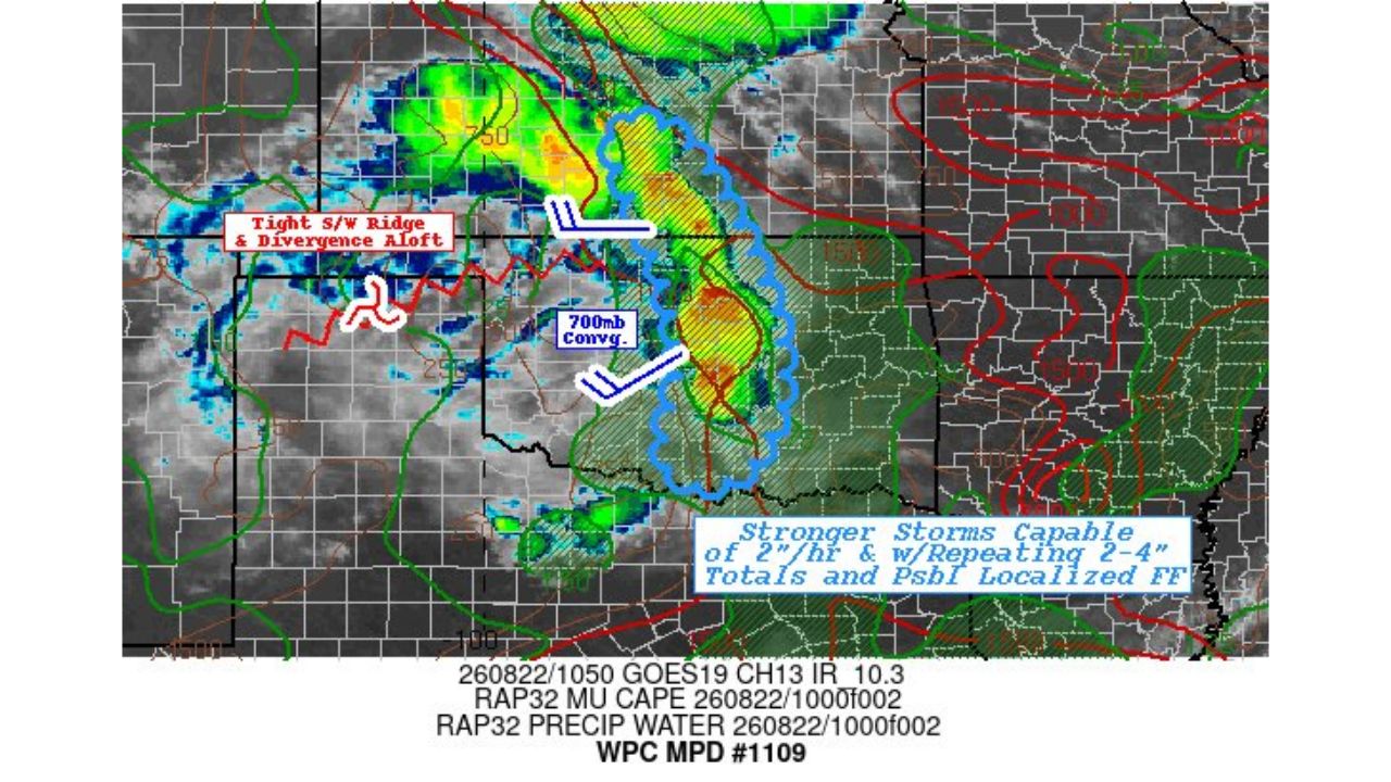
PURCELL — The Weather Prediction Center flagged a developing flash flooding concern across central Oklahoma and south-central Kansas early Saturday, warning that stronger storms embedded in the system are capable of rainfall rates up to 2 inches per hour, with repeating storms potentially dropping 2 to 4 inch totals and raising the risk of localized flash flooding.
The discussion pointed to a tight upper-level ridge and divergence aloft to the west as one driver of the setup, alongside 700 mb convergence feeding into the storm complex, technical signals forecasters use to identify where the atmosphere is best organized to support repeating, intense rainfall.
Why Rain Rate Matters More Than Total Here
A 2 inch per hour rainfall rate is intense enough on its own to overwhelm storm drains and low-lying roads even in a brief burst, but the real concern in this discussion is what happens if storms repeat over the same corridor rather than passing through once. When that happens, a storm capable of 2 inches an hour can stack multiple rounds on top of each other, pushing area totals to 2 to 4 inches and creating the kind of concentrated, fast-developing flooding that catches drivers and low-lying property owners off guard, even without any single storm looking especially dramatic on radar.
What to Watch For as the System Continues
As of this writing, this is a Mesoscale Discussion, not a confirmed flash flood watch or warning. No flash flood watches tied to this specific discussion have been issued yet. This article will be updated as watches, warnings, or confirmed flooding reports come in from central Oklahoma or south-central Kansas.
For more coverage like this, check back for the latest severe weather updates.