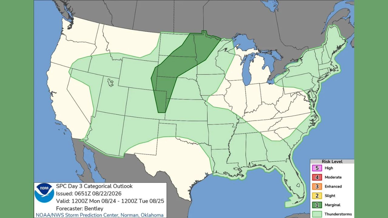
RAPID CITY — A Marginal Risk of severe weather covers a corridor from the central High Plains into the northern Plains for Monday, Aug. 24, according to the Storm Prediction Center’s Day 3 outlook, issued in the early morning hours Saturday. The highlighted zone runs roughly from western Nebraska and Kansas north through South Dakota and into North Dakota, with a much broader Thunderstorms Possible area stretching across nearly the entire eastern two-thirds of the country.
- Highest risk level: Marginal (1 of 5)
- Valid: 1200Z Monday, Aug. 24 through 1200Z Tuesday, Aug. 25
- Issued: 0651Z, Aug. 22, 2026
- Forecaster: Bentley, SPC Norman, Oklahoma
- Marginal zone: central High Plains into the northern Plains, roughly western Nebraska/Kansas through the Dakotas
- Surrounding Thunderstorms Possible zone: most of the eastern US, from the Gulf Coast through the Northeast
Why a Day 3 Outlook Carries Less Certainty
Outlooks issued three days ahead of the event, like this one covering Monday, come with inherently more uncertainty than a Day 1 forecast, since forecasters are working from broader model trends rather than the finer-scale data available closer to the event. The Marginal designation itself, the lowest tier on the SPC’s five-level scale, reflects that early-stage confidence: forecasters see enough signal in the central and northern Plains to flag isolated severe storm potential, but the setup remains far enough out that specifics on timing, exact location, and hazard type will likely sharpen considerably as Monday approaches.
What to Watch For as Monday Approaches
As of this writing, this is a Day 3 outlook and does not represent a confirmed watch or warning. No severe thunderstorm watches tied to this corridor have been issued, and none would be expected this far in advance. This article will be updated as the outlook is refined in subsequent Day 2 and Day 1 updates leading up to Monday.
For more coverage like this, check back for the latest severe weather updates.